Proactive Planning for Resilience: Protocols for Community-Led Climate Adaptation in Virginia
Step 1: Initial Assessment and Community-Led Prioritization
Actions:
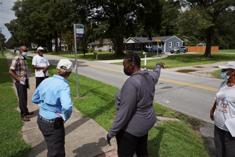
- Engage with the full community in the beginning and throughout the entire process to ensure their early and continuous input into the assessment of local climate change risks, vulnerabilities, and impacts. A locality can create an adaptation planning workgroup with representatives from across the community to help lead this effort.
- Collaborate with local experts and community leaders to obtain input and to ground-truth models and data. Create substantive roles and opportunities for input from representatives of traditionally marginalized or under-represented groups.
- Seek personalized interactions and find community liaisons who can be “trusted messengers” to engage with socially vulnerable and Environmental Justice communities.
- Initiate a concerted effort to locate senior and disabled residents spread throughout the community, who may need additional assistance during and after flooding, severe storms and extreme heat events. For example, engage with Department of Social Services representatives who work with senior and disabled residents through programs such as Meals on Wheels, to enlist their aid in finding where those populations are living and distributing information to them.
- Conduct the risks and impacts assessment across services and programs: infrastructure (transportation, wastewater and stormwater, housing, critical medical services, water and energy supply, etc.), social services and healthcare, the economy, emergency services, and historic, cultural and natural resources. See the “Helpful Tools and Resources” section below for some suggested tools to assist with this assessment.
- Determine the sequence of impacts: what will be impacted first – septic systems, roads, homes, hospitals, businesses, or other key infrastructure? When will properties become inaccessible, and uninhabitable?
- Consider predicted changes in the frequency, severity and extent of each risk.
- Consider distinct impacts on vulnerable communities such as low income residents, senior citizens, mentally and physically disabled residents, those for whom English is not their primary language, and children. The American Association of Retired Persons (AARP) estimates that the population aged 65 and over living on the coasts has soared from over 8.36 million in 1970 to over 21.6 million in 2022.1 In partnership with FEMA, AARP developed a toolkit that local governments can use to be better prepared to protect their senior residents during a disaster: AARP Disaster Resilience Tool Kit.
- Make sure to well-document current risks with data, mapping, and photographs.
- When assessing risks and impacts from increasing heat, remember the tie between planning for extreme heat and planning for adequate water supply for drinking, cooling and fire suppression. For more information, see FEMA’s website Get #SummerReady | Ready.gov and NOAA Climate Program Office’s Co-creating Community Solutions to Compound and Complex Extreme Heat Impacts Across the U.S. – Climate Program Office. See also HEAT.gov for information on how to address heat-related impacts, including its federal funding opportunities page.
- Note: There are four categories of extreme heat mitigation activities funded by FEMA’s Hazard Mitigation Assistance: mitigation planning, multi-hazard risk reduction, climate-resilient building, and resilience hubs. For more information, see this FEMA fact sheet. There are 4 planning tools that FEMA identifies as most useful in extreme heat planning: The Climate Mapping for Resilience and Adaptation assessment tool, the Climate Risk and Resilience Portal (ClimRR), the GIS Resilience Analysis and Planning Tool, and the National Risk Index. It is also important for local governments to remember that federal funds may not be available to address recovery from extreme heat events if an emergency has not been declared. The federal Stafford Act authorizes the President to issue two types of declarations to provide federal assistance to jurisdictions (local, state, tribal or territorial) in response to a public health incident: an “emergency declaration” or a “major disaster declaration.”2 There has not yet been a presidential declaration of emergency in response to extreme heat, and extreme heat is not listed among the disasters in the Stafford Act that can trigger a major disaster declaration3; but “emergency” is defined broadly in the Act, and potentially could include public health emergencies triggered by heat-related impacts.4 There have been efforts to advocate for Congress to explicitly adapt disaster relief programs to cover extreme heat.5
- Similarly, when assessing flooding impacts, remember to plan for inundated, unusable drinking water wells and saturated ground that cannot absorb any more precipitation after heavy localized rainfall – even if it is not a named storm event, like a hurricane.
- Collaborate with adjacent localities when needed to assess and address cross-border risks. Assessments should be both local and regional, since water, heat, tribal territories, and vulnerable communities can cross jurisdictional lines.
- Once completed, publicize the results of the vulnerability and risk assessments, get community feedback, and revise accordingly. Continue open dialogue with concerned community partners.
1 Craig Welch, “Washed Away – Special Report: Older Americans in Peril.” AARP Magazine, May 28, 2024. https://www.aarp.org/home-family/your-home/info-2024/washed-away.html
2 Robert T. Stafford Disaster Relief and Emergency Assistance Act, Public Law 93-288, as amended, 42 U.S.C. 5121 et seq.
3 “‘Major disaster’ means any natural catastrophe (including any hurricane, tornado, storm, high water, wind driven water, tidal wave, tsunami, earthquake, volcanic eruption, landslide, mudslide, snowstorm, or drought), or, regardless of cause, any fire, flood, or explosion, in any part of the United States, which in the determination of the President causes damage of sufficient severity and magnitude to warrant major disaster assistance under this chapter to supplement the efforts and available resources of States, local governments, and disaster relief organizations in alleviating the damage, loss, hardship, or suffering caused thereby.” 42 U.S.C. § 5122(2).
4 Congressional Research Service, Insight, Stafford Act Assistance for Public Health Incidents (updated March 15, 2024), https://crsreports.congress.gov/product/pdf/IN/IN11229#:~:text=The%20Stafford%20Act%20authorizes%20the,a%20%E2%80%9Cmajor%20disaster%20declaration.%E2%80%9D. See 42 U.S.C. §
5122(1): “‘Emergency’ means any occasion or instance for which, in the determination of the President, Federal assistance is needed to supplement State and local efforts and capabilities to save lives and to protect property and public health and safety, or to lessen or avert the threat of a catastrophe in any part of the United States.”
5 See Congressional Research Service, Insight, Emergency Response to Extreme Heat: Federal Financial Assistance and Considerations for Congress (updated April 9, 2024), https://crsreports.congress.gov/product/pdf/R/R46873
- Consider using the Resilience Adaptation Feasibility Tool (RAFT) Planning for Resilience: Evaluation and Prioritization (PREP) Tool to conduct a resilience assessment for a locality.
- During the assessment, look for opportunities to integrate the locality’s various plans. See the U.S. Department of Homeland Security’s Plan Integration for Resilience Scorecard (oup_coetools_plan-integration-scorecard_190424-508.pdf (dhs.gov)) for helpful information about integrating a community’s planning efforts.
- Make sure the locality’s Emergency Operations Plan is fully developed, sufficient and up to date. For this, see FEMA’s Comprehensive Preparedness Guide and other Planning Guides.
- Organize citizen volunteer groups ahead of time that can be activated when their neighborhood/community is not impacted by an emergency, so they are already organized to help assist nearby communities that are affected. For example, FEMA has a Community Emergency Response Team (CERT) program that educates volunteers about disaster preparedness.
- An Emergency Operations Plan needs to include extreme heat as well as flooding and wildfires. See, for example, the North Carolina Office of Recovery Resiliency’s Heat Action Plan Toolkit. A locality also needs to plan for drought as a potential consequence of extreme heat, and assess impacts on residents (particularly vulnerable populations), tourism, agriculture, hospitals and shelters, and major employers and producers of key products such as medical supplies.
- Define terms such as “resilience”, “resilient community” and “social resilience”. Develop a common parlance to be used while setting community goals and priorities. “Resilience” is the ability of a community to survive and bounce back from disastrous events and natural hazards, and “adaptation” is a long-term process that increases community resilience by altering an approach, use or behavior to adjust to changing conditions.
- Ask residents what a resilient property looks like, and what it represents to them – preserving economic value, a way of life, a community legacy, recreational uses, or property to be passed on to heirs?
- Local governments also need to ensure that their community members understand what is meant by the terms “100-year flood” and “100-year storm”, which are commonly used terms in disaster planning. People often think that a “100-year flood” is an event that is so large that it occurs only once every 100 years. But that is not what hydrologists mean by the term; they refer to a 100-year flood as one that, based on historical rainfall and flooding data, statistically has a 1-percent chance of occurring in any given year. But a flooding event of that size can occur two years in a row, or even multiple times a year – it’s not probable, but it is possible. Similarly, a “100-year storm” also is an event that statistically has a 1-percent chance of occurring in any given year. For more information on these terms, community members can reference the United States Geological Survey’s Water Science School website, The 100-Year Flood | U.S. Geological Survey.
- When engaging the community, look at resilience holistically, and build social and economic networks.
- Connect with community leaders so they can spearhead efforts to engage residents, and obtain their participation and support for adaptation planning.
- Seek to understand a community’s culture and history, and take the time to build trust before discussing adaptation.
- Establish Adaptation Focus Areas using a broad definition of Resilience that encompasses not just buildings and infrastructure but also human health and wellbeing (e.g., flooding impacts, food security, and potential loss of social cohesion due to relocating communities), economic concerns (employment, tax base, tourism, and agriculture), natural resources (green space, forests and wetlands, water and air quality, wildlife and habitats), etc. For example, the Focus Areas could be Social Services, Health & Wellbeing, Economy & Tourism, Physical Infrastructure, Emergency Planning & Response, and Natural, Historic & Cultural Resources. Consider creating a stakeholders committee to assist with each focal area.
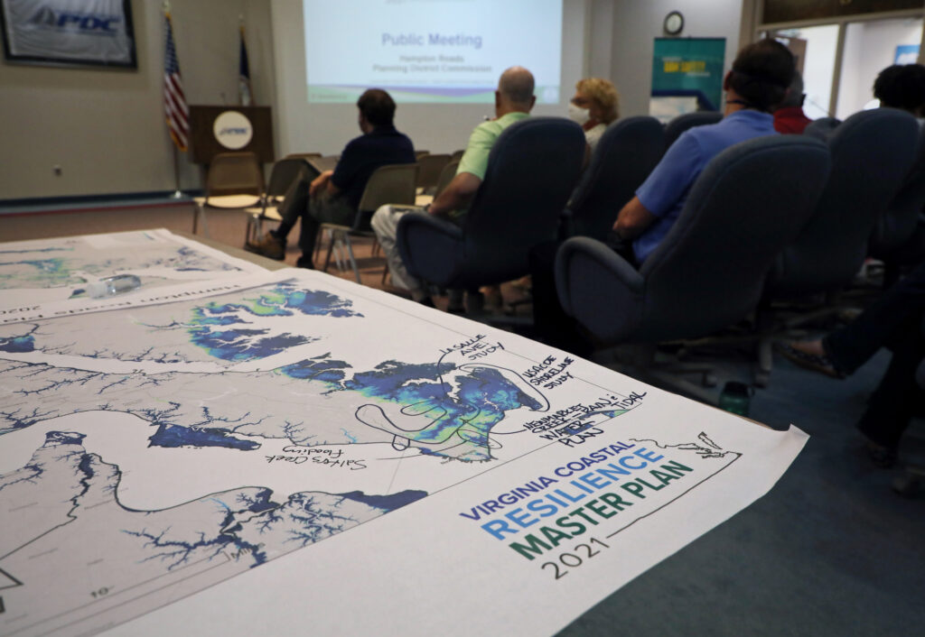
- Gather information from the community using methods such as interviews, focus groups, community meetings and workshops, and surveys.
- Consider offering community participatory mapping (see the Duke University Nicholas Institute’s Method Overview: Participatory Mapping).
- Also see the Virginia Chapter of the American Planning Association’s webinar on using storytelling as a form of community engagement, particularly with underserved communities: CM # 9283516, Storytelling Not Yelling Toward Inclusive Public Engagement.
- Host meetings during the daytime and evenings, and in a variety of locations accessible by public transportation, to be accessible to as many residents as possible.
- Provide translations of printed materials for ESL communities, and translation services at public meetings when needed.
- Consider accessing staff training from PhotoVoice (https://photovoice.org/) – which offers online courses worldwide in participatory photography for engagement with under-represented communities – or a similar source.
- Post information about the adaptation planning effort at frequently-accessed spaces such as libraries, grocery stores, post offices, and food banks, and in local newspapers as well as on the locality’s website and social media sites. Keep information up to date, so citizens know they can rely upon those resources.
- Build partnerships with external partners such as religious organizations, local businesses, homeowners associations, or NGOs already active in the community to expand local government engagement efforts; and collaborate with them to identify vulnerable communities. Include academia when it is helpful. To help inform residents about current and predicted climate change impacts, and obtain valuable anecdotal information, consider enlisting the realtor community’s assistance. For example, University of Maryland Extension staff offer training for realtors on wells, water quality, and septic systems, which includes a discussion of the potential impacts of flooding and sea level rise.
- Don’t forget to survey the local government staff as well, since they are often residents of the locality and may have excellent insights into community resilience and adaptation needs.
- Political leaders should avoid undermining a community’s resilience priorities in the face of development pressure. Planning for climate change impacts includes identifying the most vulnerable areas, and those areas should not then be sites for planned economic development, in order to avoid putting more people and buildings in harm’s way.
- If relocation is being considered as an option, conduct a suitability analysis for areas that could receive relocating residents; and assess the social, economic, and infrastructure impacts to those anticipated receiving communities. The receiving areas for relocating residents will need to have the amenities and services that are prioritized by residents during the community engagement and information gathering efforts. For more on relocation, see Step 2.
Best Practices:
- In order to have an equitable community planning process that addresses the underlying drivers of vulnerability, all residents’ voices must be welcome at the table and justice concerns must be at the center of each step in the process. The Fifth National Climate Assessment by the U.S. Global Change Research Program emphasizes that effective adaptation requires centering equity and collaborating and communicating with historically disenfranchised or disinvested communities. Full community engagement means obtaining community members’ input, not just informing them of governmental decision making after the fact. And building trust with socially vulnerable community members to gain their participation and input takes significant time, effort, and resources. In order to have a truly transparent, inclusive and effective planning process, discriminatory history and disproportionate impacts on vulnerable communities have to be acknowledged and addressed.
- Flooding and heat will disproportionately impact socially vulnerable communities. A 2024 report by The Union of Concerned Scientists noted that between now and 2050, sea level rise due to climate change will expose more than 1,600 critical buildings and services to disruptive flooding at least twice per year, with more than half of the infrastructure at risk located in disadvantaged communities – particularly impacting affordable housing.1 Government-led relocation efforts also can cause social and psychological impacts such as a loss of community and sense of place, and those impacts are often disproportionately borne by marginalized communities that lack the funding or capacity to increase their resilience.2 Due to this likelihood of environmental justice concerns being implicated in managed relocation efforts, localities should actively work to identify these issues and to use funding and relocation resources equitably. See Step 2 of this Guide for more information on relocating residents away from risks.
- When engaging community members to obtain their input into adaptation planning, use both accessible quantitative data and qualitative input obtained through interviews and focus groups.
1 “Looming Deadlines for Coastal Resilience,” Union of Concerned Scientists, https://doi.org/10.47923/2024.15502. The study encompassed the contiguous United States, Puerto Rico, the U.S. Virgin Islands and Guam.
2 A.R. Siders and Idowu Ajibade, “Introduction: Managed retreat and environmental justice in a changing climate,” Journal of Environmental Studies and Sciences, 11, (2021): 287-293, https://link.springer.com/content/pdf/10.1007/s13412-021-00700-6.pdf.
Community Engagement Concerns:
- Community engagement is key in this first step in the process of adaptation planning, as the community should feel like an active participant in the decision-making process right from the start.
- It is important to partner with community liaisons who can establish trust and build bridges with communities, and also inform adaptation planning efforts concerning local history and priorities. See the Maryland Department of Natural Resources’ Adaptation and Resiliency Working Group panel discussion on using community liaisons for effective community engagement: https://youtu.be/M40ORT1sQz4?feature=shared.
- It takes time, effort and resources to build trust and relationships with disadvantaged communities. Approach communities with sensitivity, not urgency; and tell participants what their shared information will be used for and where it will be shared.
- Participants need to be compensated appropriately for their time and insights. Provide them with resources, and honoraria or stipends for their participation.
- An important step is understanding what the community sees as the foremost risks and concerns to be addressed, and combining that understanding with insight gained from selected tools.
- Note that not every tool includes demographic considerations, which are important for accounting for equity concerns, as low-income and disadvantaged areas often face more risk than affluent areas or have fewer resources available to address their risks.
- Differential impacts based on factors like age and ability should be considered; various populations may have different needs that should be addressed in different ways as some people may not be able to move homes readily or live in an area without accommodations.
- When reaching out to communities to obtain their input into adaptation planning efforts, it is important for local governments to recognize that some communities have experienced bias or discrimination that has increased both their vulnerability to climate change impacts and their distrust of government. Government staff can use equitable collaboration methods to help them engage in authentic and productive discussions with these communities. The Institute for Engagement and Negotiation at the University of Virginia has developed Six Key Principles of Equitable Collaboration to assist communities as they engage in difficult conversations about planned uses of public spaces. According to those principles, an equitable engagement is:
- Trauma-Informed – Recognizes past and ongoing harms and potential traumas; the engagement process is designed to prevent renewed trauma
- Inclusive – Reaches all segments of a community, acknowledges racial, ethnic, gender, class and other dynamics as integral for meaningful participation
- Responsive – Acknowledges community questions, needs, concerns and ideas in a meaningful way
- Deliberative – Fosters brave spaces where participants honestly and openly confront past and present, for learning, growing, and shared civic thinking
- Truth-Seeking – Invites honest, more complete histories, especially when such histories are painful to hear and understand
- Adaptive – Uses appropriate process to achieve local goals and adapt to changing circumstances.
For an overview of the six principles and a toolkit to assist communities with engaging in equitable and effective discussions, see Overview of the Key Principles of Equitable Collaboration | Transforming Community Spaces.
Examples:
Maine Sea Grant joined with other partners1 to address the need for accurate local socio-economic information to guide adaptation decisions at the local level. They worked to develop and pilot a tool to provide zip code-level socioeconomic data for coastal fishing communities in Maine. Their work highlighted the need for additional support for socially vulnerable rural communities, as well as the need to compile the best available data and then ground-truth that information with the local knowledge of community members. They also discovered some important-takeaways, including the fact that the U.S. Census Bureau’s American Community Survey tracks primary employment, but members of these communities often have multiple sources of income that need to be taken into account. They also found that there is a need to account for seasonal residents and an increasing number of remote workers.
For more information, see Maine Fishermen’s Forum Guide for Local Decision Making with Economic Data and Partnerships. The project sprung from national level training that the partners had developed in partnership with NOAA, Estimating the Local Marine Economy; that training led to the project in Jonesport and Beals as a means to work with community members’ local knowledge.
1 The towns of Jonesport and Beals, Sunrise County Economic Council, Maine Sea Grant and University of Maine Extension, Downeast Institute, University of Maine at Machias, Margaret Chase Smith Policy Center at University of Maine and rbouvier consulting.
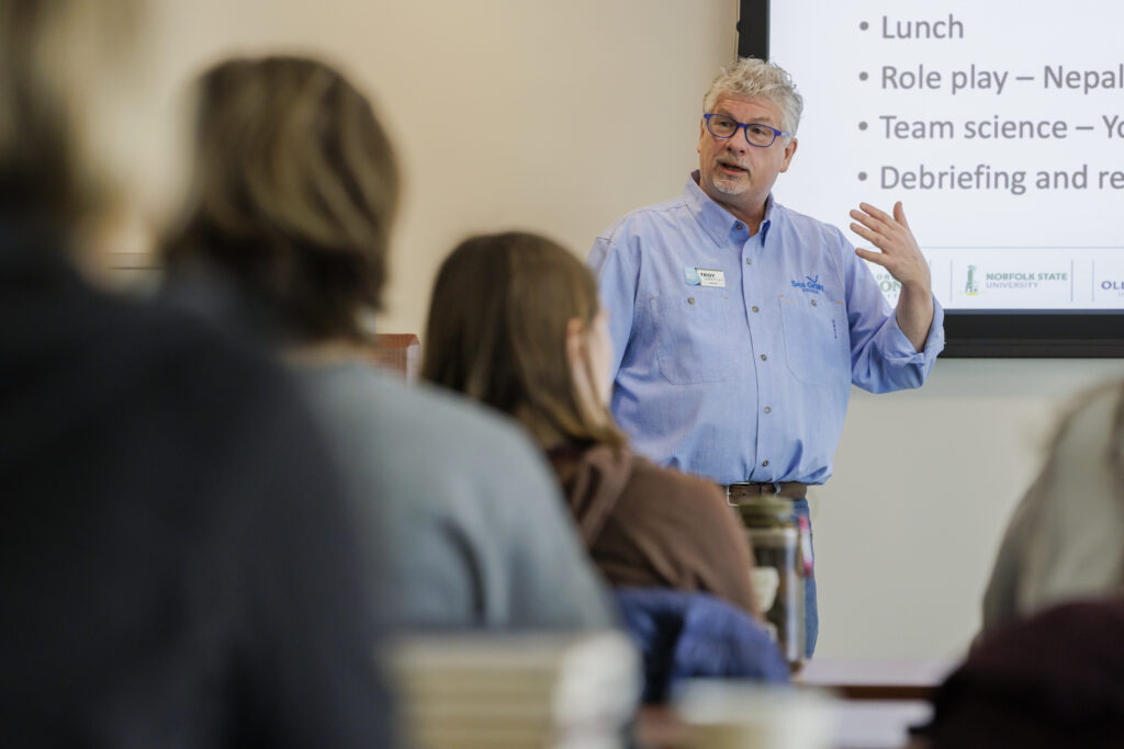
The Resilience Adaptation Feasibility Tool (The RAFT) is a long-term, successful multi-university partnership. The current partners are the Institute for Engagement and Negotiation at the University of Virginia, the Institute for Climate Adaptation and Resilience at Old Dominion University, and the Center for Coastal Studies at Virginia Tech. The program works closely with local governments in Virginia to help them increase their resilience to climate change impacts.
The RAFT is composed of three steps:
1) Objective quantitative and qualitative assessments of how much a locality has incorporated resilience into its programs and policies, using a specially-developed RAFT Scorecard and interviews and focus groups.
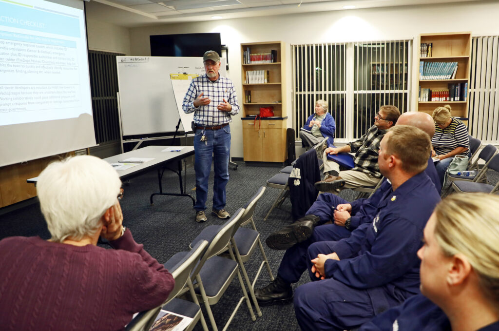
2) The hosting of a regional workshop in partnership with the regional planning district commission, at which each locality’s representatives develop a Resilience Action Checklist of efforts they want to undertake over the course of a year to increase their resilience.
3) A full year of support from the three university partners, including hosting and facilitating monthly meetings of community representatives who work through the selected list of resilience actions.
The program has demonstrated how consistent, grass roots community engagement over the course of 18 months, supported by facilitation and research, can result in increased awareness of climate change risks, greater community feedback and involvement in the process, and progress on a broad range of resilience priorities that can include emergency response, resilience planning, food security, economic development and jobs, and affordable housing. The RAFT is conducted at no cost to the local governments.
See the RAFT website (Resilience Adaptation Feasibility Tool – RAFT (virginia.edu)) for more information.
Takeaways: Building trust with communities – particularly socially vulnerable ones – takes time, effort and resources. It does not happen quickly due to a number of reasons, including lack of resources, mistrust of government due to past discriminatory policies, and stakeholders working multiple jobs so they cannot easily attend meetings. Working with “trusted messengers” who are recognized by communities as valued partners can help to ease distrust and enable fuller discussion with more stakeholder involvement and input.
- Multi-state: In 2021, three Great Lakes Sea Grant programs (Illinois-Indiana, Minnesota, and Pennsylvania) partnered to address the impacts of flooding and extreme weather events in socially vulnerable communities through stormwater management planning and green infrastructure implementation. Their efforts focused on improving resilience to climate-related hazards “one block at a time” with projects in four communities: Duluth, Minnesota; Erie, Pennsylvania; and Michigan City and Hammond, Indiana. In Duluth, they hosted a Barrels and BBQ neighborhood block party/education event paired with a “rain barrels for residents” program. The partners developed a community assessment and engagement toolkit, One Block at a Time, that can be used by communities nationwide.
- Florida: After Hurricane Michael caused catastrophic damage to communities in the Florida panhandle in 2018, the State issued a Hurricane Michael Citizen Participation Plan to increase the opportunity for citizen involvement in the development of the Rebuild Florida recovery plan. They used a variety of approaches to engage with citizens and “meet them where they are” as much as possible.They hosted 98 mobile pop-up events across HUD- and state-identified Most Impacted and Distressed (MID) areas to increase accessibility for residents of rural and LMI (low and moderate income) communities who could not travel to a Rebuild Florida center or needed additional in-person assistance; and they conducted in-person canvassing in those communities at sites such as food bank distribution centers, gas stations, and local stores and markets.
- Hosting an advertised discussion hour at a coffee shop when staff will be present to answer questions also can be a successful way to reach residents. Another option is to have a drive-up site, curbside, in a heavily-frequented area such as a grocery store parking lot, where information can be distributed to residents. Or, local governments can rent a vacant storefront and have a pop-up display concerning the community’s adaptation planning.
- Cuba: The main mechanism which Cuba has used to engage its communities about the country’s climate change plan has been its higher and primary educational institutions. They have leveraged higher education institutions to provide formal education degrees in sustainability as well as community workshops. Primary schools also have been used to educate youth about how climate change will impact Cuba. The goal of these programs is to help the community understand the gravity of the climate situation so they will rally around climate initiatives. To see more about Cuba’s climate plan, see this case study.
- For an example of a community resilience plan that includes a description of their extensive stakeholder engagement, see the Tallahassee, Florida Community Resilience Plan adopted in 2019: https://www.talgov.com/uploads/public/documents/publicsafety/resplansm.pdf.
- In the Grand River Watershed, Planners used the EPA’s Equitable Resilience Builder tool to ensure equitable outcomes through community engagement when creating a watershed resilience plan. To see more about the process, see this storymap.
Helpful Tools and Resources:
There are many tools available to assist local governments in assessing their current and predicted impacts, risks and vulnerabilities due to climate change. NOAA’s Mid-Atlantic Regional Integrated Sciences and Assessments (MARISA) offers a Chesapeake Bay Climate Adaptation Toolbox that is designed to help users identify the best decision-support tool to address their needs. It is an excellent reference for local governments in Virginia undertaking adaptation planning. In addition, the US Climate Resilience Toolkit, which provides information from across federal agencies, also is very helpful, including its Steps to Resilience.
Some key factors to keep in mind when selecting tools to support adaptation planning, tools should:
- Be simple to use and visually clear, so a variety of local government staff and local residents find them accessible. If there is concern about this, then appointing training liaisons could be useful.
- Provide finer-scale data, both current and predictive, with community-specific, local, and regional data sources.
- Have the ability to provide visualization of local changes, and scenario evaluation. It can be helpful to show actual damage and impacts for the area being discussed.
- Include social vulnerability metrics.
- Support co-production of data with communities.
For an extensive list of some available tools listed according to purpose, see here.
Case Studies:
In 2024, The Nature Conservancy MD/DC, George Mason University and the Environmental Finance Center at the University of Maryland partnered on a collaborative adaptation planning project in Crisfield, Maryland to reduce nuisance flooding impacts and build community resilience. Funded by a NOAA Climate Program Office Adaptation Sciences (AdSci) Program grant, the work took a community-engaged approach to climate adaptation planning, including anthropologic research to characterize local understandings of climate change and flooding, and participatory planning touch points with local government staff and residents of Crisfield. The research team noted that the time spent on preliminary interviews before the organized engagement activities contributed to the foundational trust needed to have difficult conversations and facilitate discussion, and also provided initial insights into how the community was thinking about flooding, resilience, and climate change. Sharing gleaned lessons back with the community demonstrated that the research team was listening to them, and that they valued their insights. This further led to increased trust. The researchers also noted:
- It was very important to include the community in the assessment and research process through a number of workshops that included participatory mapping exercises, open discussion, refinement of adaptation scenarios, and identification of local infrastructure. This ensured that the process was addressing the issues that the community found most important, and facilitated a two-way knowledge exchange that was important for the team’s analysis and the community’s understanding of local concerns and appropriate adaptation measures.
- Doing in-depth community engagement work can be very messy, and it is important to remain flexible and admit fault when appropriate. The team made some missteps and had to be adaptive. They were able to recover because they listened to local perspectives and were able to pivot in ways that brought even more people into the project.
- The decision-making process relied on understanding what was important to the community in terms of their goals and community assets, assessing vulnerability due to flooding and associated damages, developing adaptation scenarios that modify vulnerability and risk, weighing updated scenarios based on important community criteria, and evaluating the feasibility of options. Also, there were criteria in addition to flood vulnerability that were important for the community to consider; for example, how did flooding impact the ability for children to get to school, or for the local economy to flourish? These criteria came out through various conversations with community members and local government.
- Long-term strategies were explored and chosen through discussions with the local government based on their priorities and interests. Crisfield did not have much capacity to consider long-term adaptation options considering the frequent flood issues they face in addition to larger damages from big storms. Conversations the team had with the local government and some of the opportunities that resulted from the project facilitated more long-term thinking and planning within Crisfield.
For more information, see the project’s report and ArcGIS Storymap.
Research team insights shared via personal communication with Joseph Galarraga, Coastal Resilience Project Manager, TNC MD/DC, July 2024.
Cuba Tarea Vida: Cuba has adopted a 100-year plan to address its climate resilience issues. This plan was adopted due to a combination of its commitments to the United Nations Framework Convention on Climate Change, unacceptable projected climate scenarios showing significant areas of the island to be lost to inundation from sea level rise, and the destruction of Hurricane Irma in 2017. The 100-year plan is broken down into shorter time segments which allow for obtainable goals to be created and for built-in evaluation points to keep the process iterative. For more information, see the Cuba Tarea Vida Case Study.
Tribal Nations: Many Tribal Nations, including several in Virginia, have adopted an extended or seven-generation timeline for adaptation planning. Localities with tribal communities may want to consider how they will work with and incorporate Tribal Nations’ longer-term timelines when crafting adaptation plans. For more information, see this case study on the WAMPUM Adaptation Framework.
One example of statewide climate planning is Oregon’s Sea Level Rise Adaptation Planning Toolkit. In 2022, the Oregon Coastal Management Program (OCMP) developed a guidebook and toolkit for coastal communities adapting to sea level rise. Like many other climate planning guides, the Oregon Sea Level Rise Planning document outlines key steps for localities, including assessing vulnerability, examining the existing policy landscape, identifying strategies, and a consideration of legal issues. The guide emphasizes the dynamic nature of planning, accounting for changes in communities and data. Importantly, the document also emphasizes the need for equitable community engagement in each section, setting a precedent for localities to do the same.
Oregon looked at three different time horizons (2040, 2070, 2100) for sea level rise, and it encourages localities to use the same NOAA data, ensuring statewide consistency. The guidebook notes that communities should use sea level rise projections that will have an impact on populations and assets regardless of the predicted time horizon, since time horizons are not precise. They further highlight the uncertainty in interactions between global carbon emissions and sea level rise, but maintain that localities should still plan in advance for climate change.
Although this is a state, not local-level plan, there are some important takeaways for Virginia localities:
- Localities should consider equitable community engagement in each section of a climate plan. Residents should be involved in both identifying vulnerabilities and strategies for resilience.
- Communities across the state using the same SLR projections would maintain consistency and ease coordination.
- Existing policies, plans, and ordinances should be audited to examine where resilience is lacking and what legal barriers a locality may face in climate planning.
For more information, see this article from Surfrider on Oregon’s Release of a Sea Level Rise Adaptation Planning Toolkit.
The Netherlands’ Room for the River project, which involved undertaking a unified nationwide project to implement significant infrastructural changes in order to decrease reliance on river dikes and expand floodplains, can offer some important lessons on successful methods of community engagement. These include:
- Making decisions based on a broad, not single-issue agenda. The project was spatial in nature, and decisions and negotiations revolved around economic development, spatial quality, housing, agriculture, cultural preservation, etc.
- Encouraging initiative from local representatives (including water boards, industry interest groups, property owners, etc.), allowing them to take the lead on ideation, planning, and implementation wherever possible. Conversations were encouraged to be loose and informal, allowing all stakeholders to participate and all topics to be addressed. Discussions were fluid.
- If an amicable and mutually agreeable consensus with holdout property owners could not be reached, authorities expanded their choice sets by offering them fair funds for either rebuilding in a more resilient manner or relocating. Eminent domain and other compulsory forces were sometimes necessary, but were not looked to as a primary option.
Read more about the Netherlands’ Room for the River methods here.
